What Happened
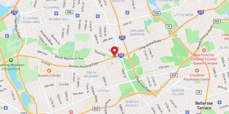
A crash on the westbound Long Island Expressway (I-495) in Queens County prompted the closure of the right lane on Tuesday, May 26, 2026, according to incident records. The collision was classified as moderate severity, resulting in at least one lane of traffic being taken out of service during what is historically one of the busiest travel periods on this major regional corridor.
Specific details about the crash — including the exact time of the incident, the number of vehicles involved, the types of vehicles, and the precise mile marker or exit location — remain limited. Police have not yet confirmed the identities, ages, or hometowns of any individuals involved, and no official statements from responding agencies had been issued at the time of this report. It is also not yet confirmed which law enforcement or emergency response agencies were dispatched to the scene, though incidents of this nature on I-495 in Queens County typically draw a response from the New York State Police and potentially the NYPD, depending on jurisdiction.
The right lane closure on a westbound stretch of the LIE during daytime hours carries significant implications for commuters. The Long Island Expressway is a primary artery connecting Long Island to New York City, and any lane reduction — even a single right lane — can quickly produce backups extending several miles, particularly near the Queens-Nassau County border and in the vicinity of major interchanges such as the Cross Island Parkway, the Van Wyck Expressway, and the Grand Central Parkway. Whether delays extended to those interchange points was not confirmed in available data, and police have not yet released further operational details.
Witness accounts and social media posts reviewed as part of this report did not contain verified, incident-specific information about this crash. Two posts identified on Bluesky Social from the same timestamp window did not reference the I-495 incident and are unrelated in content. A second Bluesky post similarly contained no traffic-related information pertinent to this crash. Neither post is treated as a source of factual content for this report.
No charges, arrests, or fatalities have been reported in connection with this incident at this time. The investigation into the cause of the crash, including any determination of speed, impairment, distracted driving, or mechanical failure, remains ongoing. Further updates are expected as official sources release additional information.
Location & Road Context
The crash took place on I-495, the Long Island Expressway, one of the most heavily trafficked and incident-prone roadways in the New York metropolitan area. The westbound direction through Queens County represents the final stretch of the LIE before it feeds into the Midtown Tunnel approach and the broader New York City street grid, making lane closures in this zone particularly disruptive for commuters heading into Manhattan.
According to the Long Island Traffic incident database, I-495 has accumulated 802 recorded incidents — a figure that underscores the highway’s status as the region’s most collision-heavy corridor. On the day of this crash alone, May 26, 2026, the database logged multiple separate events on the same road, including additional crash reports and several roadwork entries. Queens County itself accounts for 41 recorded accidents in the local incident database, reflecting consistent pressure on this urban-suburban transitional zone. Drivers in this stretch are advised to monitor real-time conditions through 511NY before travel.
Broader Impact
The pattern of incidents on I-495 in the days surrounding this crash — including an overturned vehicle on May 24, two separate crashes on May 25, and a disabled vehicle also on May 25 — illustrates the sustained congestion and collision risk on this corridor heading into the Memorial Day holiday week. High-volume travel days are statistically associated with elevated crash rates on New York highways, and motorists using the LIE during this period are encouraged to allow additional travel time and maintain safe following distances, particularly near active lane closures.
Updates
- Jul 2, 2026: Additional reporting merged into this article: “Crash on I-495” (via 511ny)