What Happened
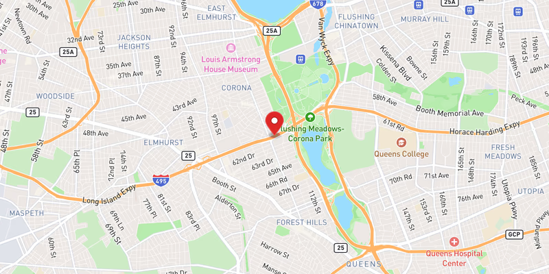
Flooding on the eastbound Long Island Expressway (I-495) in Queens County blocked three left lanes on Monday, August 3, 2026. The incident was rated minor in severity, though the lane closures created a significant bottleneck on one of the busiest highway corridors in the New York metropolitan area during what proved to be an exceptionally chaotic day on that stretch of road.
Three left lanes of the eastbound I-495 were taken out of service by standing water, forcing traffic to merge into the remaining right lanes. No injuries were reported in connection with this specific flooding event, and no vehicles were reported disabled or involved in collisions directly attributed to this incident.
August 3 brought a cluster of water-related and traffic disruptions to the same corridor. In addition to this flooding event, a second separate flooding incident on I-495 was also recorded as minor on the same date, indicating that accumulating water was a widespread problem along the expressway. A moderate crash on I-495 and at least two minor crashes were also logged on August 3, along with a disabled vehicle and scheduled tree-trimming work — meaning drivers faced hazards from multiple simultaneous incidents across the Queens segment of the LIE.
Location & Road Context
The Long Island Expressway in Queens is among the most congested urban highway segments in the United States, serving as the primary artery linking Manhattan and Brooklyn to Nassau County and points east on Long Island. The eastbound lanes in Queens handle heavy outbound commuter and freight traffic daily, and any multi-lane blockage — particularly on the left side, where faster-moving traffic concentrates — tends to produce cascading backups that extend back toward the Midtown Tunnel and the BQE interchange.
I-495 carries 2,039 recorded incidents in the Long Island Traffic database, and Queens County accounts for 221 recorded accidents in our local database. The density of incidents on August 3 alone — flooding, crashes, and a disabled vehicle all on the same corridor within hours — illustrates how quickly conditions on this road can deteriorate when weather and traffic volume interact.
Broader Impact
Standing water across multiple lanes of a high-speed interstate poses a hydroplaning risk even at moderate speeds, and the left-lane concentration of this flooding is notable: left lanes on the LIE typically carry traffic moving at or above the posted 55 mph limit, where water on the pavement dramatically reduces tire contact and stopping ability. Drivers encountering unexpected lane closures in those conditions face heightened rear-end collision risk, a pattern visible in the multiple crashes recorded on I-495 on the same day.
No external agency press release or news outlet report was available for this specific incident at time of publication. Details are drawn from official 511NY incident records. Additional facts will be added as they become available.