State Parkway · Nassau County

Wantagh State Parkway Traffic & Accidents

No crashes or closures reported 511NY feed as of 9:07 AM, Sep 28: 0 crashes, 0 closures, 0 active work zones on the Nassau Wantagh State Parkway. Live details →
511 crash records, 90 days
18
Length
12 mi
Exits
9
Speed limit
55 mph (lower posted limits on the Wantagh Causeway and at interchange ramps)
Daily traffic
50k

Wantagh State Parkway Right Now — Nassau

Monday, September 28, 9:07 AM: 0 crashes, 0 closures, 0 active work zones on the Nassau Wantagh State Parkway. Source: 511NY (NYSDOT) event feed; this page is rebuilt through the day, so check the time above.

511NY lists no crashes, closures or active work zones on the Nassau Wantagh State Parkway (511NY feed as of 9:07 AM, Sep 28).

Today's timeline — Nassau

No 511NY crash or incident records on the Nassau Wantagh State Parkway since midnight.

Scheduled work, not yet in effect (1)
  • Exit W1 → W2W: Brush Hollow Road SB – Old Country Road - Town of Hempstead Line · Southbound — Monday September 28th, 2026 thru Friday October 2nd, 2026, Monday thru Friday, 10:00 AM thru 01:00 PM

Live data: 511NY. "In effect" = still in the 511 feed at 9:07 AM and inside its posted schedule. Impact labels come from lane closures in the 511 record, not measured delay.

Recent Wantagh State Parkway Reports

All Long Island accident reports →

Wantagh State Parkway 511 Incident History — Last 90 Days

18 crash records on the Nassau Wantagh State Parkway in the 511NY feed, Jun 30, 2026 – Sep 28, 2026 , plus 9 other incident records (disabled vehicles, debris, police activity). By direction: 9 northbound, 8 southbound, 1 both directions.

Exits with the most crash records

Exit 511 location Records
Exit W3W Hempstead Turnpike (Hempstead)
3
Exit W4W Southern State Parkway (Hempstead)
3
Exit W2E Old Country Road (Hempstead)
2
Exit W2W Old Country Road - Town of Hempstead Line (Hempstead)
2
Exit W4E Southern State Parkway (Hempstead)
2
Exit W6 Merrick Road (Hempstead)
2
Exit W1 Brush Hollow Road SB (North Hempstead)
1
Exit W3E Hempstead Turnpike (Hempstead)
1
Exit W5E NY 27 (Hempstead)
1

Crash records by hour reported

Busiest hours: 3p–4p (5), 7a–8a (2), 2p–3p (2).

By day of week

  • Sun0
  • Mon1
  • Tue4
  • Wed1
  • Thu3
  • Fri6
  • Sat3
How these numbers are counted

Trailing 90 days. Nassau + Suffolk records only. Crash records = 511 accident-class records titled Crash, Vehicle fire or Overturned vehicle; other incident records (disabled vehicles, debris, police activity) are counted separately. One collision can produce more than one 511 record, so these are record counts, not verified crash totals. Hour and weekday use the 511 "Reported" time (Eastern). No clearance-time figure is published: our database does not store when 511 closed a record. Window: Jun 30, 2026 – Sep 28, 2026. Exit and location names are 511NY's own labels. Federal fatal-crash data for this road is in the next section.

Deaths on Wantagh State Parkway, 2010–2024: the federal record

The federal Fatality Analysis Reporting System records 33 deaths in 29 crashes on Wantagh State Parkway in Nassau and Suffolk counties from 2010 through 2024. 2 of the dead (6%) were pedestrians. 55% of the crashes happened in darkness. These are distinct police-reported fatal crashes, not news reports, and they are separate from the incident tallies elsewhere on this page.

Fatal crashes
29
People killed
33
Pedestrians
2
Bicyclists
0
Motorcyclists
6
Vehicle occupants
25
Deaths on Wantagh State Parkway by year, Nassau and Suffolk counties
3’103’110’121’130’142’152’161’173’186’193’202’213’223’231’24
View the chart as a table
YearFatal crashesDeaths
201033
201123
201200
201311
201400
201522
201612
201711
201833
201946
202033
202122
202233
202333
202411

Where along the road

CommunityCrashesDeaths
Wantagh77
North Wantagh44
Westbury34
Levittown34
New Cassel22
Hicksville12
East Meadow11

Community = the 2020 Census place containing the crash coordinates.

When

  • Of 29 crashes with a recorded time: 16 between 8 p.m. and 6 a.m., 4 between 4 and 8 p.m., 5 between 10 a.m. and 4 p.m., 4 between 6 and 10 a.m.
  • 4 crashes killed more than one person.

Counts are not adjusted for traffic volume or length, so they show where deaths occurred, not which road is riskiest per mile driven. Crashes are matched to this road by the name police recorded; service roads are counted separately. 2024 is preliminary. Source: NHTSA FARS, retrieved 2026-09-17. Method · All records (CSV)

Wantagh State Parkway by Town

Town pages exist where we have at least 10 tracked reports and the town's own 511 or federal crash data.

Route Overview

From
Northern State Parkway (Salisbury / East Meadow area, Nassau County)
To
Jones Beach State Park (via the Wantagh Causeway)
Also Known As
Wantagh Parkway, Wantagh Pkwy, Wantagh State Pkwy, Wantagh Causeway, NY 908, wantagh-stpkwy, wantagh-pkwy

Why the Wantagh State Parkway Matters

Congestion

One of Long Island's most seasonally congested parkways — Jones Beach summer weekends routinely saturate the corridor and back traffic onto the Northern State Parkway.

History

Built in the early 1930s under Robert Moses as part of the original Jones Beach State Parkway system. One of Long Island's first landscaped beach parkways, with low stone-faced overpasses that bar trucks and buses by design.

About the Wantagh State Parkway

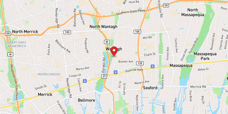
The Wantagh State Parkway — locally just “the Wantagh,” and carried on NYSDOT records as unsigned reference route NY 908 — is the western of Nassau County’s two great beach parkways. Running roughly 12 miles north–south, it connects the Northern State Parkway in the Salisbury/East Meadow area down through Levittown, Wantagh, and Seaford, across the Southern State Parkway and Sunrise Highway, and out over the Wantagh Causeway to Jones Beach State Park. It carries an estimated 50,000 vehicles on a typical day, with sharp seasonal swings: summer beach weekends can more than double mainline volume and back traffic onto the Northern State Parkway, a pattern documented since the 1960s and never satisfactorily engineered away on the parkway’s narrow, fixed footprint.

Construction history (the Moses era)

The Wantagh Parkway was built in the early 1930s under New York power broker Robert Moses as part of the original Jones Beach State Parkway system — the network of landscaped, truck-free roads Moses designed to deliver city and suburban families to his showcase beach. It was among the first parkways on Long Island to feature the distinctive low stone-faced overpass bridges that became a Moses signature. Those bridges were not merely decorative: their deliberately low clearances physically barred buses and commercial trucks, a design philosophy that shaped — and, critics later argued, restricted — who could reach Jones Beach.

The communities along the route grew up in the parkway’s shadow after World War II. Levittown, begun by William Levitt in 1947, was the template for mass-produced American suburbia, and the Wantagh Parkway was its primary highway artery. What began as a leisure road to the beach became, within a generation, a daily commuter spine — a tension between recreation and commute that still defines the corridor.

Route geometry (north to south)

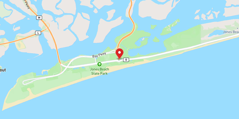
From its northern terminus at the Northern State Parkway, the Wantagh runs south through Levittown, crossing Hempstead Turnpike (NY 24) and Jerusalem Avenue. It then reaches its busiest junction, the Southern State Parkway interchange (Exit W4) in the Levittown/Wantagh area, before continuing south through Wantagh across Sunrise Highway (NY 27) and Merrick Road. South of Merrick Road the parkway climbs onto the Wantagh Causeway, a low bridge-and-fill crossing over the bay marshes and Jones Inlet that delivers traffic to the western fields of Jones Beach State Park. Exit numbers use the parkway’s W-prefixed scheme (W1 through W9), descending from the Northern State end southward toward Merrick Road and the causeway. Roughly three miles to the east, the Meadowbrook State Parkway runs the same north–south beach errand, and the two together form Nassau’s primary beach-access pair.

Jurisdiction and patrol

New York State Police Troop L holds primary patrol and crash-investigation authority on the Wantagh State Parkway. The NY State Park Police cover the Jones Beach approaches at the southern end. The Nassau County Police Department (NCPD) assists at major incidents but is not the primary investigative agency on the parkway mainline. One operational quirk matters in winter: the roadway is maintained by the NYS Office of Parks, Recreation and Historic Preservation (OPRHP), not NYSDOT. Parkways historically received lower snow-clearance priority than expressways like the LIE; heavy commuter volume has improved response in recent decades, but ice in the shadow zones beneath the narrow stone underpasses and on the wind-exposed causeway remains a persistent cold-weather hazard.

Speed limits, trucks, and the low bridges

The general posted limit on the open mainline is 55 mph, with lower posted limits on the Wantagh Causeway and on interchange ramps, especially at the Southern State and Sunrise Highway connections and approaching Jones Beach, where beach and pedestrian traffic mixes with through traffic in season. As a New York State parkway, the Wantagh prohibits all commercial vehicles, trucks, and buses. That restriction is enforced not just by signage but by physics: several Moses-era overpasses carry clearances under 8 feet, and over-height rental vans and box trucks that ignore the posted clearance warnings cause recurring bridge strikes — a hazard largely absent from truck-legal roads like the LIE.

Recent Editorial Coverage

Recent Long Island Traffic reporting and analysis touching the Wantagh corridor:

For the complete Wantagh Parkway accident archive, see /accidents/ and filter by road.

Towns Along This Route

Frequently Asked Questions

Is there traffic on the Wantagh State Parkway right now?

511NY feed as of 9:07 AM, Sep 28: 0 crashes, 0 closures, 0 active work zones on the Nassau Wantagh State Parkway. 1 more work zone is scheduled for later. See the live section at the top of this page for locations.

What happened on the Wantagh State Parkway today?

511NY has not carried any crash or incident on the Nassau Wantagh State Parkway since midnight (511NY feed as of 9:07 AM, Sep 28).

Which Wantagh State Parkway exits have the most crash reports?

In 511NY records for Jun 30, 2026 – Sep 28, 2026, the Nassau exits with the most crash records were Exit W3W (Hempstead Turnpike, 3), Exit W4W (Southern State Parkway, 3), Exit W2E (Old Country Road, 2). These are 511 record counts, not verified crash totals; the method is shown in the 511 incident history section.

How long is the Wantagh State Parkway and where does it go?

The Wantagh State Parkway runs roughly 12 miles north–south through central Nassau County. It begins at the Northern State Parkway in the Salisbury/East Meadow area, runs south through Levittown, Wantagh, and Seaford, crosses the Southern State Parkway and Sunrise Highway, then continues over the Wantagh Causeway to Jones Beach State Park. It is the western parallel to the Meadowbrook State Parkway.

Can trucks use the Wantagh Parkway?

No. Commercial vehicles, trucks, and buses are prohibited on the Wantagh State Parkway, as on every New York State parkway. The prohibition is physically enforced by the low stone-faced overpass bridges from the Moses era, several of which have clearances under 8 feet. Over-height box trucks and rental vans that ignore posted clearance signs are a recurring cause of bridge strikes.

Does the Wantagh Parkway go to Jones Beach?

Yes. The Wantagh State Parkway is one of the two main beach-access roads to Jones Beach State Park, reaching the western section of the park via the Wantagh Causeway over the bay. The parallel Meadowbrook State Parkway, about three miles east, reaches the central and eastern fields. Both saturate on warm-weather weekends.

How many accidents happen on the Wantagh Parkway each year?

Long Island Traffic's running corpus and NYSDOT crash data are consistent with several hundred reported crashes per year on the corridor, heavily concentrated in the May–September beach season. Total volume is lower than the LIE or Southern State because the parkway is shorter and truck-free, but per-crash severity is elevated by narrow lanes, fixed stone abutments, and limited shoulders.

Who patrols the Wantagh State Parkway?

New York State Police Troop L has primary patrol and crash-investigation jurisdiction on the Wantagh State Parkway. NY State Park Police cover the Jones Beach approaches at the southern end. The Nassau County Police Department assists at major incidents but is not the primary investigative agency on the parkway itself. The roadway surface is maintained by NYS OPRHP rather than NYSDOT.

What is the speed limit on the Wantagh Parkway?

The general posted speed limit is 55 mph on the open mainline. Lower limits are posted on the Wantagh Causeway and on interchange ramps, particularly at the Southern State and Sunrise Highway connections. Drivers should expect reduced limits and tighter geometry approaching Jones Beach, where pedestrian and beach traffic mixes with through traffic in summer.

Is the Wantagh Parkway the same as the Wantagh road test site?

No. The Wantagh State Parkway is a limited-access state parkway connecting the Northern State Parkway to Jones Beach. The 'Wantagh road test' refers to the NYS DMV driving-test route on local streets in the hamlet of Wantagh, which is unrelated to the parkway. This page covers live conditions, crashes, and safety data for the parkway.

What towns does the Wantagh Parkway run through?

Working north to south, the Wantagh State Parkway passes through or borders Levittown, Wantagh, and Seaford in Nassau County before reaching the Wantagh Causeway and Jones Beach. Levittown — William Levitt's archetypal postwar suburb — grew up directly alongside the parkway, which served as the development's primary highway access. The heaviest beach loads run southbound on summer mornings and northbound on Sunday and holiday evenings.

Roads That Connect to the Wantagh State Parkway

The Wantagh State Parkway interchanges directly with these Long Island highways and parkways. Check live conditions on a connecting corridor before you reroute.

Sources