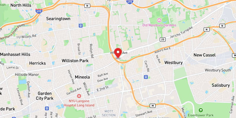
Roadway · Nassau & Suffolk County

Jericho Turnpike Traffic & Accidents

No crashes or closures reported 511NY feed as of 9:07 AM, Sep 28: 0 crashes, 0 closures, 0 active work zones on the Nassau/Suffolk Jericho Turnpike. Live details →
511 crash records, 90 days
10
Length
30 mi
Speed limit
30–45 mph (30 mph through village business districts)
Daily traffic
40k

Jericho Turnpike Right Now — Nassau/Suffolk

Monday, September 28, 9:07 AM: 0 crashes, 0 closures, 0 active work zones on the Nassau/Suffolk Jericho Turnpike. Source: 511NY (NYSDOT) event feed; this page is rebuilt through the day, so check the time above.

511NY lists no crashes, closures or active work zones on the Nassau/Suffolk Jericho Turnpike (511NY feed as of 9:07 AM, Sep 28).

Today's timeline — Nassau/Suffolk

No 511NY crash or incident records on the Nassau/Suffolk Jericho Turnpike since midnight.

Scheduled work, not yet in effect (6)
  • Drainage improvements, Milling, Guard rail repairs, Repaving on NY 25 · Both Directions — Monday September 28th, 2026 thru Friday October 2nd, 2026, Monday/Tuesday/Wednesday/Thursday, 10:00 PM thru 06:00 AM
  • Drainage improvements, Guard rail repairs, Milling, Repaving on NY 25 · Both Directions — Monday September 28th, 2026 thru Friday October 2nd, 2026, Monday thru Friday, 10:00 AM thru 03:00 PM
  • Traffic signal repairs on NY 25 · Both Directions — Monday September 28th, 2026 thru Friday October 2nd, 2026, Monday thru Friday, 10:00 AM thru 03:00 PM
  • Repaving on NY 25 · Both Directions — Monday September 28th, 2026 thru Friday October 2nd, 2026, Monday thru Friday, 10:00 AM thru 03:00 PM
  • on NY 25 · Both Directions — Monday September 28th, 2026 thru Friday October 2nd, 2026, Monday thru Friday, 10:00 AM thru 03:00 PM
  • Milling, Repaving on NY 25 · Both Directions — Sunday September 27th, 2026 thru Friday October 2nd, 2026, Sunday/Monday/Tuesday/Wednesday/Thursday, 10:00 PM thru 06:00 AM

Live data: 511NY. "In effect" = still in the 511 feed at 9:07 AM and inside its posted schedule. Impact labels come from lane closures in the 511 record, not measured delay.

Recent Jericho Turnpike Reports

All Long Island accident reports →

Jericho Turnpike 511 Incident History — Last 90 Days

10 crash records on the Nassau/Suffolk Jericho Turnpike in the 511NY feed, Jun 30, 2026 – Sep 28, 2026 (7 Nassau, 3 Suffolk), plus 9 other incident records (disabled vehicles, debris, police activity). By direction: 7 eastbound, 2 westbound, 1 both directions.

Exits with the most crash records

Exit 511 location Records
Exit 39 Glen Cove Road (North Hempstead)
2
Exit 40W Jericho Turnpike (Jericho)
2

Crash records by hour reported

Busiest hours: 6a–7a (2), 1p–2p (2), 3p–4p (2).

By day of week

  • Sun1
  • Mon0
  • Tue2
  • Wed1
  • Thu2
  • Fri2
  • Sat2
How these numbers are counted

Trailing 90 days. Nassau + Suffolk records only. Crash records = 511 accident-class records titled Crash, Vehicle fire or Overturned vehicle; other incident records (disabled vehicles, debris, police activity) are counted separately. One collision can produce more than one 511 record, so these are record counts, not verified crash totals. Hour and weekday use the 511 "Reported" time (Eastern). No clearance-time figure is published: our database does not store when 511 closed a record. Window: Jun 30, 2026 – Sep 28, 2026. Exit and location names are 511NY's own labels. Federal fatal-crash data for this road is in the next section.

Deaths on New York Route 25, 2010–2024: the federal record

The federal Fatality Analysis Reporting System records 182 deaths in 167 crashes on New York Route 25 (Jericho Turnpike, Middle Country Road and Main Road) in Nassau and Suffolk counties from 2010 through 2024. 54 of the dead (30%) were pedestrians. 55% of the crashes happened in darkness. These are distinct police-reported fatal crashes, not news reports, and they are separate from the incident tallies elsewhere on this page.

Fatal crashes
167
People killed
182
Pedestrians
54
Bicyclists
7
Motorcyclists
27
Vehicle occupants
94
Deaths on Jericho Turnpike by year, Nassau and Suffolk counties
14’1017’1113’1210’138’1410’157’167’1715’1813’1913’2013’2113’2217’2312’24
View the chart as a table
YearFatal crashesDeaths
20101314
20111717
20121313
20131010
201488
20151010
201667
201777
20181015
20191113
20201313
20211313
20221113
20231317
20241212

Where along the road

CommunityCrashesDeaths
Coram1516
Selden1313
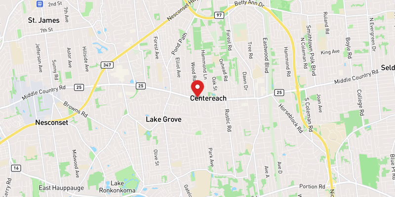
Centereach1213
Commack1213
Ridge610
Elwood88
Middle Island68
New Hyde Park57
Jericho55
Huntington Station55
Village of the Branch55
Garden City Park55

Community = the 2020 Census place containing the crash coordinates.

When

  • Of 167 crashes with a recorded time: 80 between 8 p.m. and 6 a.m., 41 between 4 and 8 p.m., 37 between 10 a.m. and 4 p.m., 9 between 6 and 10 a.m.
  • Nassau: 33 deaths in 31 crashes; Suffolk: 149 deaths in 136 crashes.
  • 8 crashes killed more than one person.

Counts are not adjusted for traffic volume or length, so they show where deaths occurred, not which road is riskiest per mile driven. Crashes are matched to this road by the name police recorded; service roads are counted separately. 2024 is preliminary. Source: NHTSA FARS, retrieved 2026-09-17. Method · All records (CSV)

Route Overview

From
Queens border at Floral Park (continues west as Hillside Avenue)
To
Smithtown (NY 25 continues east as Middle Country Road)
Also Known As
Route 25, NY 25, NY-25, Jericho Tpke, the Turnpike

Why the Jericho Turnpike Matters

Congestion

One of Long Island's busiest surface arterials and among the highest crash-per-mile non-highway roads in both Nassau and Suffolk Counties, driven by hundreds of signalized and driveway conflict points.

History

Follows a colonial-era east–west route across Long Island. Chartered as a private toll turnpike in the early 19th century and named for the Quaker hamlet of Jericho in Nassau County. Later absorbed into the state highway system as NY 25.

About Jericho Turnpike

Jericho Turnpike — signed as New York State Route 25 — is one of Long Island’s oldest and most heavily used surface roads, a commercial spine that has functioned as the island’s east–west “Main Street” since the colonial era. Where the Long Island Expressway moves traffic over Long Island at highway speed, Jericho Turnpike moves it through the heart of every community it touches: an at-grade arterial lined with retail plazas, car dealerships, diners, and downtowns, punctuated by hundreds of traffic signals and driveway cuts. That character makes it indispensable to local life and, simultaneously, one of the highest crash-per-mile non-highway roads in both Nassau and Suffolk Counties.

History

The corridor follows one of Long Island’s original colonial-era post routes. In the early 19th century it was formalized as a privately operated toll turnpike, taking its name from Jericho, the historic Quaker hamlet in central Nassau County that anchored the route. After the turnpike era ended and the road passed into public ownership, it was folded into the state highway system and designated NY 25. The “Jericho Turnpike” name survives on the western portion of that designation, from the Queens border east to roughly Smithtown.

Route geometry (west to east)

The Jericho Turnpike name begins at the Queens–Nassau border in Floral Park, where Queens’ Hillside Avenue becomes NY 25. From there the road runs roughly west-to-east through the dense inner-Nassau suburbs: New Hyde Park, Garden City Park (junction with Nassau Boulevard), and Mineola, where NY 25A splits off to follow the North Shore. Continuing east, it passes through the Williston Park / Albertson area, Roslyn Heights, and into Jericho itself near the Route 106/107 junction and the Route 135 (Seaford–Oyster Bay Expressway) corridor. It then runs through Syosset and Woodbury before crossing into Suffolk County.

In Suffolk, the road threads through Cold Spring Harbor and into the Huntington area, where it crosses NY 110 — one of the busiest signalized junctions on the entire corridor. It continues east through Elwood (along the Dix Hills border), Commack, and into Smithtown, where the Jericho Turnpike name gives way to Middle Country Road. The NY 25 designation itself does not stop there: it carries on east through central Suffolk and out along the North Fork as Main Road, ultimately terminating at Orient Point more than 100 miles from where it started — but only the western ~30-mile segment is what Long Islanders mean when they say “Jericho Turnpike.”

Jurisdiction and patrol

Jericho Turnpike is a state highway maintained by NYSDOT Region 10, but because it is a surface arterial rather than a limited-access highway, day-to-day enforcement falls to local police rather than New York State Police. The Nassau County Police Department (NCPD) patrols the Nassau sections and the Suffolk County Police Department (SCPD) patrols the Suffolk sections, while incorporated-village police departments — including Floral Park and Mineola — enforce traffic within their own boundaries. This patchwork of jurisdictions is one reason crash reporting on the corridor is spread across multiple agencies.

Speed limits and commercial character

Posted speed limits range from 30 mph through village business districts (Floral Park, Mineola, downtown Huntington) to 40–45 mph in less developed stretches. Because the road is an at-grade arterial with frequent signals, crosswalks, and commercial entrances, the posted limit changes repeatedly along the route, and real-world travel speeds during peak periods are far lower. The intense commercial development — strip retail, big-box plazas, auto dealerships, and restaurants — generates a steady stream of turning movements and pedestrian activity that defines both the road’s economic importance and its crash profile.

Recent Editorial Coverage

Recent Jericho Turnpike (NY-25) incidents documented by the Long Island Traffic data desk:

For the complete NY 25 accident archive, see /accidents/ and filter by road.

Towns Along This Route

Frequently Asked Questions

Is there traffic on the Jericho Turnpike right now?

511NY feed as of 9:07 AM, Sep 28: 0 crashes, 0 closures, 0 active work zones on the Nassau/Suffolk Jericho Turnpike. 6 more work zones are scheduled for later. See the live section at the top of this page for locations.

What happened on the Jericho Turnpike today?

511NY has not carried any crash or incident on the Nassau/Suffolk Jericho Turnpike since midnight (511NY feed as of 9:07 AM, Sep 28).

Is Jericho Turnpike the same as Route 25?

Yes. Jericho Turnpike is the common name for New York State Route 25 from the Queens border at Floral Park east through Nassau County and into western Suffolk County. Around Smithtown the same NY 25 designation continues east under the names Middle Country Road and then Main Road, ultimately reaching Orient Point on the North Fork. In Queens, the western continuation of the corridor is Hillside Avenue.

How long is Jericho Turnpike?

The stretch of NY 25 that carries the 'Jericho Turnpike' name runs roughly 30 miles from the Queens border in Floral Park east to Smithtown. The full NY 25 route designation continues well beyond that — east through central Suffolk as Middle Country Road and out to Orient Point as Main Road — for a total of more than 100 miles, but only the western portion is signed as Jericho Turnpike.

Why is it called Jericho Turnpike?

The road follows one of Long Island's oldest colonial-era east–west land routes. It was formalized as a turnpike — a privately operated toll road — in the early 19th century and took its name from Jericho, the historic Quaker hamlet in Nassau County that served as a key landmark on the route. After the turnpike era it became a public highway and was eventually designated NY 25.

What is the speed limit on Jericho Turnpike?

The speed limit varies by segment, generally between 30 and 45 mph. Through village business districts and dense commercial stretches — such as Floral Park, Mineola, and downtown Huntington — it drops to 30 mph, while less developed sections post 40–45 mph. Because Jericho Turnpike is an at-grade arterial with frequent signals and pedestrian crossings, posted limits change often along the route.

Who patrols Jericho Turnpike?

Jericho Turnpike is a state route maintained by NYSDOT Region 10, but as a surface arterial it is patrolled by local police rather than the State Police. The Nassau County Police Department covers the Nassau sections and the Suffolk County Police Department covers the Suffolk sections, with incorporated-village police departments (such as Floral Park and Mineola) enforcing traffic within their own boundaries.

What towns does Jericho Turnpike pass through?

From west to east, NY 25 passes through Floral Park, New Hyde Park, Garden City Park, Mineola, the Williston Park/Albertson area, Jericho, Syosset, and Woodbury in Nassau County, then crosses into Suffolk County through Cold Spring Harbor, Huntington, Elwood, Commack, and Smithtown. East of Smithtown the route continues as Middle Country Road and Main Road toward Riverhead and the North Fork.

Why does Jericho Turnpike have so many accidents?

Jericho Turnpike is a high-volume at-grade arterial lined with retail, restaurants, and commercial driveways. Hundreds of signalized intersections, unsignalized driveway cuts, and pedestrian crossings create constant conflict points. Left-turn crashes at driveways, rear-end crashes at signals, and pedestrian strikes in the densest commercial stretches make it one of the highest crash-per-mile non-highway roads on Long Island.

Where does Jericho Turnpike start and end?

The Jericho Turnpike name begins at the Queens–Nassau border in Floral Park, where Queens' Hillside Avenue transitions into NY 25, and continues east to Smithtown. From there the NY 25 designation carries on as Middle Country Road through central Suffolk and as Main Road through the North Fork, ending at Orient Point.

Roads That Connect to the Jericho Turnpike

The Jericho Turnpike interchanges directly with these Long Island highways and parkways. Check live conditions on a connecting corridor before you reroute.

Sources