Roadway · Nassau & Suffolk County

New York State Route 110 Traffic & Accidents

No crashes or closures reported 511NY feed as of 9:07 AM, Sep 28: 0 crashes, 0 closures, 2 active work zones on the Nassau/Suffolk New York State Route 110. Live details →
511 crash records, 90 days
10
Length
9 mi
Speed limit
30-45 mph (signalized arterial; 30 mph through village centers, up to 45 mph on divided sections)
Daily traffic
50k

New York State Route 110 Right Now — Nassau/Suffolk

Monday, September 28, 9:07 AM: 0 crashes, 0 closures, 2 active work zones on the Nassau/Suffolk New York State Route 110. Source: 511NY (NYSDOT) event feed; this page is rebuilt through the day, so check the time above.

Work zones in effect (2)

Moderate impact Northbound

Spagnoli Road

Moderate impact Southbound

Repaving, Structure repairs on NY 110

Today's timeline — Nassau/Suffolk

No 511NY crash or incident records on the Nassau/Suffolk New York State Route 110 since midnight.

Scheduled work, not yet in effect (7)
  • Drainage improvements on NY 110 · Both Directions — Sunday September 27th, 2026 thru Friday October 2nd, 2026, Sunday/Monday/Tuesday/Wednesday/Thursday, 10:00 PM thru 06:00 AM
  • Spagnoli Road · Northbound — Monday September 28th, 2026 thru Friday October 2nd, 2026, Monday/Tuesday/Wednesday/Thursday, 10:00 PM thru 06:00 AM 2 lanes of 3 lanes closed
  • Repaving, Structure repairs on NY 110 · Southbound — Monday September 28th, 2026 thru Friday October 2nd, 2026, Monday/Tuesday/Wednesday/Thursday, 10:00 PM thru 06:00 AM 2 lanes of 3 lanes closed
  • Traffic signal repairs on NY 110 · Both Directions — Monday September 28th, 2026 thru Friday October 2nd, 2026, Monday thru Friday, 10:00 AM thru 03:00 PM
  • on NY 110 · Both Directions — Monday September 28th, 2026 thru Friday October 2nd, 2026, Monday thru Friday, 10:00 AM thru 03:00 PM
  • Utility work, Repaving on NY 110 · Both Directions — Monday September 28th, 2026 thru Friday October 2nd, 2026, Monday thru Friday, 10:00 AM thru 03:00 PM
  • on NY 110 · Southbound — Monday September 28th, 2026, 10:00 AM thru 03:00 PM

Live data: 511NY. "In effect" = still in the 511 feed at 9:07 AM and inside its posted schedule. Impact labels come from lane closures in the 511 record, not measured delay.

Recent New York State Route 110 Reports

All Long Island accident reports →

New York State Route 110 511 Incident History — Last 90 Days

10 crash records on the Nassau/Suffolk New York State Route 110 in the 511NY feed, Jun 30, 2026 – Sep 28, 2026 , plus 8 other incident records (disabled vehicles, debris, police activity). By direction: 6 northbound, 3 southbound, 1 both directions.

Crash records by hour reported

Busiest hours: 7a–8a (3), 8a–9a (2), 5a–6a (1).

By day of week

  • Sun0
  • Mon1
  • Tue3
  • Wed1
  • Thu3
  • Fri0
  • Sat2
How these numbers are counted

Trailing 90 days. Nassau + Suffolk records only. Crash records = 511 accident-class records titled Crash, Vehicle fire or Overturned vehicle; other incident records (disabled vehicles, debris, police activity) are counted separately. One collision can produce more than one 511 record, so these are record counts, not verified crash totals. Hour and weekday use the 511 "Reported" time (Eastern). No clearance-time figure is published: our database does not store when 511 closed a record. Window: Jun 30, 2026 – Sep 28, 2026. Exit and location names are 511NY's own labels. Federal fatal-crash data for this road is in the next section.

Deaths on New York Route 110, 2010–2024: the federal record

The federal Fatality Analysis Reporting System records 51 deaths in 51 crashes on New York Route 110 (Broad Hollow Road and New York Avenue) in Nassau and Suffolk counties from 2010 through 2024. 35 of the dead (69%) were pedestrians. 73% of the crashes happened in darkness. These are distinct police-reported fatal crashes, not news reports, and they are separate from the incident tallies elsewhere on this page.

Fatal crashes
51
People killed
51
Pedestrians
35
Bicyclists
4
Motorcyclists
1
Vehicle occupants
11
Deaths on New York State Route 110 by year, Nassau and Suffolk counties
4’106’116’123’133’142’153’162’173’182’192’204’216’222’233’24
View the chart as a table
YearFatal crashesDeaths
201044
201166
201266
201333
201433
201522
201633
201722
201833
201922
202022
202144
202266
202322
202433

Where along the road

CommunityCrashesDeaths
North Amityville1313
East Farmingdale1212
Melville88
Huntington Station55
Huntington44
South Huntington33
Amityville33
West Hills11

Community = the 2020 Census place containing the crash coordinates.

When

  • Of 51 crashes with a recorded time: 32 between 8 p.m. and 6 a.m., 8 between 4 and 8 p.m., 7 between 10 a.m. and 4 p.m., 4 between 6 and 10 a.m.
  • 0 crashes killed more than one person.

Counts are not adjusted for traffic volume or length, so they show where deaths occurred, not which road is riskiest per mile driven. Crashes are matched to this road by the name police recorded; service roads are counted separately. 2024 is preliminary. Source: NHTSA FARS, retrieved 2026-09-17. Method · All records (CSV)

Route Overview

From
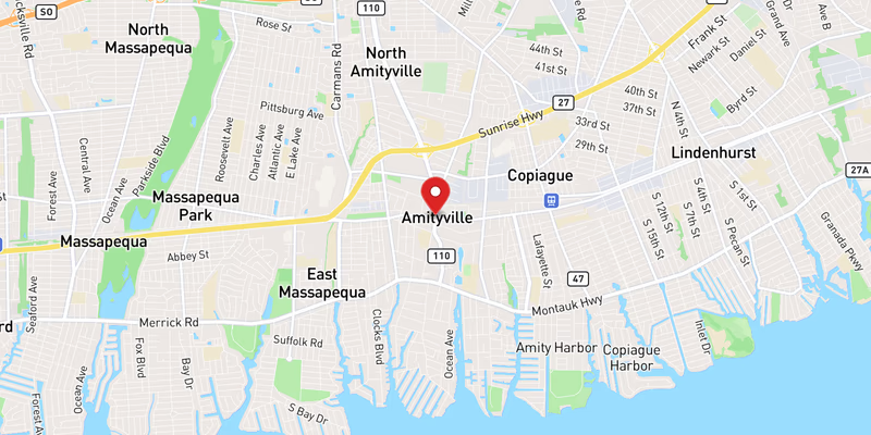
Merrick Road (NY 27A), Amityville (south shore, Suffolk County)
To
Main Street (NY 25A), Huntington Village (north shore, Suffolk County)
Also Known As
Route 110, NY 110, NY-110, Broad Hollow Road, Broadhollow Road, Walt Whitman Road

Why the New York State Route 110 Matters

Congestion

One of Long Island's busiest and most crash-prone surface arterials; the Melville segment (Broad Hollow Road) is the region's largest suburban office corridor.

History

NY 110 follows a colonial-era north-south road and received its current designation in New York's 1930 state-route renumbering. Its Melville/Broad Hollow Road segment grew into one of Long Island's largest suburban office corridors from the 1970s onward, and the northern Walt Whitman Road segment passes near West Hills, birthplace of poet Walt Whitman (1819).

About Route 110

Route 110 — officially New York State Route 110, and known locally as Broad Hollow Road in its southern reaches and Walt Whitman Road in the north — is Long Island’s busiest north–south surface arterial. In roughly 9 miles it links the south shore at Amityville to the north shore at Huntington Village, carrying an estimated 50,000 vehicles on a typical weekday across a corridor lined with traffic signals, strip retail, big-box plazas, and the office towers of the Melville business district. Unlike the limited-access expressways and parkways that cross it, Route 110 is a stop-and-go commercial street for most of its length, and its crash profile reflects that: dense driveway access, heavy turning movements, and constant pedestrian activity rather than high-speed merge conflicts.

NY 110 follows a colonial-era north–south road and received its current numbered designation in New York State’s 1930 route renumbering. For much of the 20th century it was an ordinary commercial main street; that changed in the 1970s and 1980s, when the Melville segment of Broad Hollow Road developed into one of the largest suburban office corridors in the region, drawing corporate headquarters, financial firms, and media offices to the “Route 110 corridor.” The northern Walt Whitman Road segment, meanwhile, passes near West Hills, the 1819 birthplace of poet Walt Whitman; the Walt Whitman Birthplace State Historic Site and the Walt Whitman Shops regional mall both sit on or beside the route.

Route geometry (south to north)

Route 110 begins at its southern terminus at Merrick Road (NY 27A) in the Village of Amityville, on the Suffolk County south shore. Heading north out of Amityville’s compact downtown, it immediately crosses Sunrise Highway (NY 27) and then interchanges with the Southern State Parkway, two of the south shore’s principal east–west arteries. It continues north through East Farmingdale and the Village of Farmingdale, where the route runs along the Nassau–Suffolk county line and crosses Conklin Street / Hempstead Turnpike (NY 24) and NY 109 amid a dense commercial strip near Republic Airport.

North of Farmingdale the road widens into the divided Broad Hollow Road section through Melville, passing Old Country Road and the office parks of the Melville corridor before crossing the Long Island Expressway (I-495) at Exit 49 — one of the LIE’s busiest and most crash-prone interchanges. Continuing north as Walt Whitman Road, Route 110 runs through South Huntington and Huntington Station, crosses Jericho Turnpike (NY 25), passes the Walt Whitman Shops, and reaches its northern terminus at Main Street (NY 25A) in Huntington Village.

Jurisdiction and patrol

Because Route 110 is a NYSDOT-maintained surface arterial rather than a limited-access highway, it is not patrolled by New York State Police the way the LIE and the parkways are. The Suffolk County Police Department (SCPD) has primary jurisdiction for the Suffolk County segments — Amityville, East Farmingdale, Melville, Huntington Station, and Huntington Village — while the Nassau County Police Department (NCPD) covers the Farmingdale segment on the Nassau side of the county line. The Amityville Village Police Department patrols within village limits at the southern end. NYSDOT owns the roadway, its signals, and its lane markings, and is the agency responsible for corridor safety improvements and signal-timing changes.

Speed limits

There is no single corridor-wide speed limit on Route 110. Posted limits run about 30 mph through the village centers and dense retail stretches — downtown Amityville at the south end and Huntington Village at the north — and up to 45 mph on the wider divided sections through Farmingdale and Melville. Drivers should treat Route 110 as a signal-controlled commercial street: the operative hazards are abrupt stops at signals, vehicles turning into and out of retail lots, and pedestrians crossing between plazas, not high-speed flow.

Commercial and retail character

Route 110 is, above all, a commerce corridor. Its southern and central stretches are lined with auto dealerships, fast-food outlets, shopping plazas, and service businesses, while the Melville segment hosts the office towers of the Route 110 corporate corridor — one of Long Island’s largest suburban employment centers. (This is frequently confused with the Long Island Innovation Park at Hauppauge, the former Hauppauge Industrial Park, which actually sits several miles east near LIE Exits 55–57 and is not on Route 110.) Near the northern end, the Walt Whitman Shops draw heavy regional shopping traffic to the Huntington Station segment. The result is a corridor that simultaneously serves office commuters, delivery and commercial trucks, and local retail customers — often in direct conflict at the same signalized intersections.

Recent Editorial Coverage

Recent Long Island Traffic reporting touching the Route 110 corridor:

For the complete Route 110 accident archive, see /accidents/ and filter by road.

Towns Along This Route

Frequently Asked Questions

Is there traffic on the New York State Route 110 right now?

511NY feed as of 9:07 AM, Sep 28: 0 crashes, 0 closures, 2 active work zones on the Nassau/Suffolk New York State Route 110. 7 more work zones are scheduled for later. See the live section at the top of this page for locations.

What happened on the New York State Route 110 today?

511NY has not carried any crash or incident on the Nassau/Suffolk New York State Route 110 since midnight (511NY feed as of 9:07 AM, Sep 28).

How many accidents happen on Route 110 each year?

Route 110 records roughly 800–1,100 reported crashes annually across its corridor, based on NYSDOT Motor Vehicle Crash data and Long Island Traffic's running corpus of reports. The corridor is heavily commercial, with closely spaced traffic signals, frequent driveway cuts, turning movements into retail lots, and significant pedestrian activity — all factors that elevate crash frequency on surface arterials. Rear-end and left-turn collisions are the dominant crash types.

Why is Route 110 called Broad Hollow Road and Walt Whitman Road?

Route 110 carries two local street names along its length. The southern and central section — from Amityville north through Farmingdale and into Melville — is Broad Hollow Road (often spelled Broadhollow Road), a historical landscape name. The northern section through South Huntington and Huntington Station to Huntington Village is Walt Whitman Road, honoring poet Walt Whitman, who was born in West Hills (just west of Melville/Huntington) in 1819. The Walt Whitman Birthplace State Historic Site and the Walt Whitman Shops sit on or beside this northern segment.

Does Route 110 cross the Long Island Expressway?

Yes. Route 110 crosses the Long Island Expressway (I-495) at Exit 49 in Melville — one of the most crash-prone LIE interchanges. The Route 110 corridor and the Exit 49 ramps handle very heavy commuter and commercial volumes serving the Melville office corridor. In May 2026 a large sinkhole opened in the westbound LIE lanes at Exit 49, closing lanes and nearly swallowing a car.

What is the speed limit on Route 110?

Route 110 is a signalized surface arterial, not a limited-access highway, so speed limits vary by segment. Posted limits run about 30 mph through village centers and dense retail stretches (such as downtown Amityville and Huntington Village) and up to 45 mph on the wider divided sections through Farmingdale and Melville. Drivers should watch for frequent signal changes, turning traffic, and pedestrian crossings rather than a single corridor-wide limit.

Who patrols Route 110?

Because Route 110 is a state-maintained surface road rather than a state-police-patrolled expressway, local agencies have primary jurisdiction. The Suffolk County Police Department covers the Suffolk County segments through Amityville, East Farmingdale, Melville, Huntington Station and Huntington Village. The Nassau County Police Department covers the Farmingdale segment on the Nassau side. The Amityville Village Police Department patrols within village limits. NYSDOT owns and maintains the roadway and its signals.

How long is Route 110 and where does it run?

Route 110 runs about 9 miles, almost entirely north–south. Its southern terminus is at Merrick Road (NY 27A) in Amityville on the south shore; from there it heads north past Sunrise Highway (NY 27) and the Southern State Parkway, through Farmingdale, across the LIE at Exit 49 in Melville, and through Huntington Station to its northern terminus at Main Street (NY 25A) in Huntington Village on the north shore.

Is Route 110 the access road for the Hauppauge Industrial Park?

No — that is a common mix-up. The Long Island Innovation Park at Hauppauge (the former Hauppauge Industrial Park) sits several miles east, near LIE Exits 55–57 off Motor Parkway, and is not on Route 110. Route 110's own employment hub is the Melville office corridor along Broad Hollow Road, one of Long Island's largest suburban office concentrations. Both corridors generate heavy commercial traffic, but they are distinct places.

What towns does Route 110 pass through?

From south to north, Route 110 passes through Amityville (Suffolk), the Farmingdale area straddling the Nassau–Suffolk line, Melville (Suffolk), and Huntington Station into Huntington Village (Suffolk). Each town profile on Long Island Traffic carries its own crash-frequency data, emergency-services list, and a filtered archive of recent accident reports for that municipality.

Roads That Connect to the New York State Route 110

The New York State Route 110 interchanges directly with these Long Island highways and parkways. Check live conditions on a connecting corridor before you reroute.

Sources