Roadway · Nassau County

Hempstead Turnpike Traffic & Accidents

No crashes or closures reported 511NY feed as of 9:07 AM, Sep 28: 0 crashes, 0 closures, 0 active work zones on the Nassau Hempstead Turnpike. Live details →
511 crash records, 90 days
10
Length
16 mi
Speed limit
40 mph (lower in village business districts)
Daily traffic
55k

Hempstead Turnpike Right Now — Nassau

Monday, September 28, 9:07 AM: 0 crashes, 0 closures, 0 active work zones on the Nassau Hempstead Turnpike. Source: 511NY (NYSDOT) event feed; this page is rebuilt through the day, so check the time above.

511NY lists no crashes, closures or active work zones on the Nassau Hempstead Turnpike (511NY feed as of 9:07 AM, Sep 28).

Today's timeline — Nassau

No 511NY crash or incident records on the Nassau Hempstead Turnpike since midnight.

Scheduled work, not yet in effect (2)
  • Milling, Repaving on NY 24 · Both Directions — Monday September 28th, 2026 thru Friday October 2nd, 2026, Monday/Tuesday/Wednesday/Thursday, 10:00 PM thru 06:00 AM 2 lanes of 3 lanes closed
  • Utility work on NY 24 · Westbound — Monday September 28th, 2026 thru Friday October 2nd, 2026, Monday thru Friday, 10:00 AM thru 03:00 PM

Live data: 511NY. "In effect" = still in the 511 feed at 9:07 AM and inside its posted schedule. Impact labels come from lane closures in the 511 record, not measured delay.

Recent Hempstead Turnpike Reports

All Long Island accident reports →

Hempstead Turnpike 511 Incident History — Last 90 Days

10 crash records on the Nassau Hempstead Turnpike in the 511NY feed, Jun 30, 2026 – Sep 28, 2026 (9 Nassau, 1 Suffolk), plus 7 other incident records (disabled vehicles, debris, police activity). By direction: 6 westbound, 4 eastbound.

Crash records by hour reported

Busiest hours: 4p–5p (2), 8p–9p (2), 4a–5a (1).

By day of week

  • Sun3
  • Mon1
  • Tue2
  • Wed1
  • Thu1
  • Fri0
  • Sat2
How these numbers are counted

Trailing 90 days. Nassau + Suffolk records only. Crash records = 511 accident-class records titled Crash, Vehicle fire or Overturned vehicle; other incident records (disabled vehicles, debris, police activity) are counted separately. One collision can produce more than one 511 record, so these are record counts, not verified crash totals. Hour and weekday use the 511 "Reported" time (Eastern). No clearance-time figure is published: our database does not store when 511 closed a record. Window: Jun 30, 2026 – Sep 28, 2026. Exit and location names are 511NY's own labels. Federal fatal-crash data for this road is in the next section.

Deaths on Hempstead Turnpike, 2010–2024: the federal record

The federal Fatality Analysis Reporting System records 65 deaths in 59 crashes on Hempstead Turnpike (NY 24 in Nassau County) in Nassau and Suffolk counties from 2010 through 2024. 34 of the dead (52%) were pedestrians. 68% of the crashes happened in darkness. These are distinct police-reported fatal crashes, not news reports, and they are separate from the incident tallies elsewhere on this page.

Fatal crashes
59
People killed
65
Pedestrians
34
Bicyclists
3
Motorcyclists
5
Vehicle occupants
23
Deaths on Hempstead Turnpike by year, Nassau and Suffolk counties
5’104’112’122’1314’143’152’164’171’184’194’207’216’225’232’24
View the chart as a table
YearFatal crashesDeaths
201055
201144
201222
201322
2014914
201533
201622
201744
201811
201944
202044
202177
202266
202345
202422

Where along the road

CommunityCrashesDeaths
East Meadow1414
Levittown99
Hempstead89
Elmont67
Farmingdale37
West Hempstead66
Franklin Square66
Uniondale33
South Farmingdale22
Plainedge22

Community = the 2020 Census place containing the crash coordinates.

When

  • Of 59 crashes with a recorded time: 32 between 8 p.m. and 6 a.m., 15 between 4 and 8 p.m., 6 between 10 a.m. and 4 p.m., 6 between 6 and 10 a.m.
  • 3 crashes killed more than one person.

Counts are not adjusted for traffic volume or length, so they show where deaths occurred, not which road is riskiest per mile driven. Crashes are matched to this road by the name police recorded; service roads are counted separately. 2024 is preliminary. Source: NHTSA FARS, retrieved 2026-09-17. Method · All records (CSV)

Hempstead Turnpike by Town

Town pages exist where we have at least 10 tracked reports and the town's own 511 or federal crash data.

Route Overview

From
Queens border / Elmont (Nassau County)
To
NY 110 / East Farmingdale (Suffolk County line)
Also Known As
Hempstead Tpke, NY 24, Route 24, NY Route 24, Hempstead Avenue

Why the Hempstead Turnpike Matters

Congestion

Ranked the #1 most dangerous road for pedestrians in the entire New York–New Jersey–Connecticut metro region for five consecutive years by the Tri-State Transportation Campaign's 'Most Dangerous Roads for Walking' analysis.

History

Originated as a colonial-era road linking Jamaica, Queens to the Town of Hempstead (founded 1644); operated as a toll turnpike in the 19th century. Designated NY Route 24 in the 1930s and was briefly the original designation of the Long Island Expressway before the LIE was reassigned as NY 495.

About Hempstead Turnpike

Hempstead Turnpike is the spine of southern-central Nassau County — a four-to-six-lane commercial arterial that carries the New York State Route 24 (NY 24) designation and runs roughly 16 miles across the most densely populated stretch of suburban Long Island. With an estimated 45,000 to 60,000 vehicles per day on its busiest Nassau segments, it is one of the most heavily traveled surface roads on Long Island. It is also, by a wide and well-documented margin, the most dangerous road for pedestrians in the entire New York metropolitan region — a distinction it held at the top of the Tri-State Transportation Campaign’s “Most Dangerous Roads for Walking” list for five consecutive years.

History

The road’s lineage reaches back to the 17th century, when it served as the primary overland route from Jamaica, Queens to the Town of Hempstead, one of Long Island’s founding communities, settled by the English in 1644. By the 19th century it had been formalized as a privately chartered toll turnpike, which is where its name comes from. It was designated NY Route 24 in the 1930s and was briefly the original route number assigned to the Long Island Expressway during construction in the late 1950s — before the LIE was reassigned as NY 495 and NY 24 returned to its Hempstead Turnpike alignment. Today the corridor is lined almost continuously with strip malls, fast-food outlets, auto dealerships, and big-box retail, the classic post-war American commercial arterial.

Route geometry (west to east)

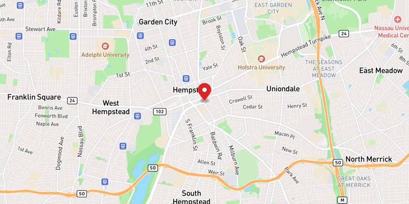
NY 24’s western segment officially begins at an interchange with Interstate 295 (the Clearview Expressway) and NY 25 in Queens Village, where it follows local streets and Hempstead Avenue east toward the Nassau County line. The road takes on the Hempstead Turnpike name as it enters Nassau County at Elmont, immediately passing the Belmont Park racetrack and the adjacent UBS Arena. From there it runs east through Franklin Square, then through West Hempstead and the downtown core of the Village of Hempstead. East of the village it skirts East Garden City, passing Hofstra University and the former Nassau Coliseum site, and crosses the Meadowbrook State Parkway near Uniondale. Continuing east through East Meadow — past Nassau University Medical Center — it reaches Levittown, where it intersects the Wantagh State Parkway, Newbridge Road, and Wantagh Avenue. Farther east it crosses NY 135 (the Seaford–Oyster Bay Expressway) in the Plainedge area, becomes Bethpage Turnpike near the Bethpage State Parkway, and finally reaches Farmingdale, where it ends at NY 110 in East Farmingdale and continues onward as Conklin Street.

Jurisdiction and patrol

The Nassau County Police Department (NCPD) holds primary patrol and crash-investigation responsibility for the bulk of the corridor. The route also threads through several incorporated villages — the Village of Hempstead, Garden City, and Floral Park — each of which maintains its own police department and patrols the segment inside its borders. NYSDOT owns and maintains the NY 24 roadway, signals, and signage. West of the Nassau line, where the road is signed as Hempstead Avenue, patrol falls to the NYPD.

Speed limits and commercial character

Most of Hempstead Turnpike is posted at 40 mph, dropping lower through village business districts. That design speed sits at the heart of the road’s safety problem: a wide, high-speed arterial runs straight through walkable downtowns, transit stops, schools, and apartment blocks, where thousands of people — including children, seniors, and non-drivers — need to cross on foot every day. The dense, driveway-heavy commercial frontage generates constant turning movements and weaving, while long gaps between signalized crosswalks push pedestrians to cross mid-block. The result is a corridor optimized for vehicle throughput but hostile to everyone outside a car.

Recent Editorial Coverage

Hempstead Turnpike coverage from the Long Island Traffic data desk:

For the complete Hempstead Turnpike accident archive, see /accidents/ and filter by road.

Towns Along This Route

Frequently Asked Questions

Is there traffic on the Hempstead Turnpike right now?

511NY feed as of 9:07 AM, Sep 28: 0 crashes, 0 closures, 0 active work zones on the Nassau Hempstead Turnpike. 2 more work zones are scheduled for later. See the live section at the top of this page for locations.

What happened on the Hempstead Turnpike today?

511NY has not carried any crash or incident on the Nassau Hempstead Turnpike since midnight (511NY feed as of 9:07 AM, Sep 28).

Is Hempstead Turnpike the same as Route 24?

Yes. Hempstead Turnpike carries the New York State Route 24 (NY 24) designation across Nassau County. NY 24 is a 30.84-mile state highway split into two segments; the western segment runs 18.68 miles from an interchange with Interstate 295 and NY 25 in Queens Village, Queens, east to NY 110 in East Farmingdale. Through Nassau County, that western segment is the road locally known as Hempstead Turnpike (and, at its eastern end, Bethpage Turnpike, Fulton Street, and Conklin Street).

Why is Hempstead Turnpike so dangerous for pedestrians?

Hempstead Turnpike has long been considered the most dangerous road for pedestrians in the New York metro region. The Tri-State Transportation Campaign's 'Most Dangerous Roads for Walking' analysis ranked SR-24 (Hempstead Turnpike) the deadliest road for walking in the entire NY–NJ–CT region for five consecutive years, with 14 pedestrian deaths recorded between 2009 and 2011 alone. A Newsday review of 2005–2010 data found 32 pedestrians killed and at least 427 injured in 457 pedestrian crashes on the corridor. The causes are structural: a four-to-six-lane arterial posted at 40 mph runs directly through dense residential downtowns, with long distances between marked crosswalks, short pedestrian signal phases, and poor sight lines at overpasses and curves.

How long is Hempstead Turnpike?

The stretch known as Hempstead Turnpike runs roughly 16 miles across Nassau County, from the Queens border near Elmont east to the Suffolk County line at Farmingdale. It forms the bulk of the 18.68-mile western segment of NY Route 24, which technically begins in Queens Village and ends at NY 110 in East Farmingdale, where the road continues as Conklin Street.

What is the speed limit on Hempstead Turnpike?

The posted speed limit on most of Hempstead Turnpike is 40 mph, with lower limits through incorporated village business districts. Traffic-safety researchers have repeatedly identified the 40 mph design speed as a core problem: at that speed, a four-to-six-lane arterial cutting through dense, walkable downtowns gives drivers little time to react to people crossing on foot.

Who patrols Hempstead Turnpike?

The Nassau County Police Department (NCPD) has primary patrol and crash-investigation responsibility for most of the Hempstead Turnpike corridor. Incorporated villages along the route — including the Village of Hempstead, Garden City, and Floral Park — maintain their own police departments and patrol the segments within their borders. NYSDOT maintains the state-route roadway itself. West of the Nassau County line, the road (as Hempstead Avenue) falls under the NYPD.

Why is it called Hempstead Turnpike?

Hempstead Turnpike was historically the main overland road connecting Jamaica, Queens to the Town of Hempstead — one of Long Island's oldest colonial communities, established by English settlers in 1644. Like Jericho Turnpike, it operated as a privately chartered toll road (a 'turnpike') in the 19th century before becoming a public highway. The Town of Hempstead remains the most populous township in New York State.

Does Hempstead Turnpike connect to UBS Arena or Belmont Park?

Yes. The western end of Hempstead Turnpike in Elmont passes near both Belmont Park — home of the Belmont Stakes, one of the three Triple Crown horse races — and UBS Arena, the 2021-built home of the New York Islanders. Major events at either venue, including Belmont Stakes weekend in June and Islanders games and concerts, generate heavy event traffic on the turnpike and the surrounding Elmont street grid.

How many accidents happen on Hempstead Turnpike each year?

Hempstead Turnpike consistently ranks among Nassau County's highest-crash roads by total annual volume, with crash counts in the range of roughly 1,200–1,600 reported collisions per year across the corridor based on NYSDOT and New York Open Data crash records. Pedestrian and bicyclist crashes are overrepresented relative to the road's traffic volume, which is what drives its long-standing reputation as the region's deadliest road for walking.

Roads That Connect to the Hempstead Turnpike

The Hempstead Turnpike interchanges directly with these Long Island highways and parkways. Check live conditions on a connecting corridor before you reroute.

Sources