State Parkway · Nassau County

Meadowbrook State Parkway Traffic & Accidents

No crashes or closures reported 511NY feed as of 9:07 AM, Sep 28: 0 crashes, 0 closures, 1 active work zone on the Nassau Meadowbrook State Parkway. Live details →
511 crash records, 90 days
26
Length
12.5 mi
Exits
10
Speed limit
55 mph
Daily traffic
100k

Meadowbrook State Parkway Right Now — Nassau

Monday, September 28, 9:07 AM: 0 crashes, 0 closures, 1 active work zone on the Nassau Meadowbrook State Parkway. Source: 511NY (NYSDOT) event feed; this page is rebuilt through the day, so check the time above.

Work zones in effect (1)

Moderate impact Both Directions

Exit M10 – Loop Parkway

Today's timeline — Nassau

  1. 7:11 AM Crash, Southbound — Exit M6W – Southern State Parkway (All lanes open). No longer listed by 511 (last seen 8:07 AM).
  2. 5:42 AM Crash, Northbound — Exit - Northern State Parkway (1 Left lane closed). No longer listed by 511 (last seen 6:21 AM).

Live data: 511NY. "In effect" = still in the 511 feed at 9:07 AM and inside its posted schedule. Impact labels come from lane closures in the 511 record, not measured delay.

Recent Meadowbrook State Parkway Reports

All Long Island accident reports →

Meadowbrook State Parkway 511 Incident History — Last 90 Days

26 crash records on the Nassau Meadowbrook State Parkway in the 511NY feed, Jun 30, 2026 – Sep 28, 2026 , plus 7 other incident records (disabled vehicles, debris, police activity). By direction: 14 northbound, 12 southbound.

Exits with the most crash records

Exit 511 location Records
Exit M1 Old Country Road (Hempstead)
8
Exit M5 NY 24 East (Hempstead)
4
Exit M6W Southern State Parkway (Hempstead)
3
Exit M2 Zeckendorf Boulevard (Hempstead)
2
Exit M3 Stewart Avenue (Hempstead)
1
Exit M6E Southern State Parkway (Hempstead)
1
Exit M7E Babylon Turnpike (Hempstead)
1
Exit M7W Babylon Turnpike (Hempstead)
1
Exit M9W Merrick Road (Hempstead)
1
Exit M10 Loop Parkway (Hempstead)
1

Crash records by hour reported

Busiest hours: 8a–9a (3), 4p–5p (3), 7p–8p (3).

By day of week

  • Sun3
  • Mon4
  • Tue5
  • Wed3
  • Thu4
  • Fri6
  • Sat1
How these numbers are counted

Trailing 90 days. Nassau + Suffolk records only. Crash records = 511 accident-class records titled Crash, Vehicle fire or Overturned vehicle; other incident records (disabled vehicles, debris, police activity) are counted separately. One collision can produce more than one 511 record, so these are record counts, not verified crash totals. Hour and weekday use the 511 "Reported" time (Eastern). No clearance-time figure is published: our database does not store when 511 closed a record. Window: Jun 30, 2026 – Sep 28, 2026. Exit and location names are 511NY's own labels. Federal fatal-crash data for this road is in the next section.

Deaths on Meadowbrook State Parkway, 2010–2024: the federal record

The federal Fatality Analysis Reporting System records 42 deaths in 33 crashes on Meadowbrook State Parkway in Nassau and Suffolk counties from 2010 through 2024. 5 of the dead (12%) were pedestrians. 52% of the crashes happened in darkness. These are distinct police-reported fatal crashes, not news reports, and they are separate from the incident tallies elsewhere on this page.

Fatal crashes
33
People killed
42
Pedestrians
5
Bicyclists
0
Motorcyclists
6
Vehicle occupants
31
Deaths on Meadowbrook State Parkway by year, Nassau and Suffolk counties
4’102’110’122’134’142’152’162’174’183’197’202’210’223’235’24
View the chart as a table
YearFatal crashesDeaths
201024
201122
201200
201312
201434
201522
201622
201722
201824
201923
202077
202122
202200
202323
202445

Where along the road

CommunityCrashesDeaths
Uniondale910
Freeport46
East Meadow45
Merrick35
Carle Place23
Roosevelt22
North Merrick22
Westbury11

Community = the 2020 Census place containing the crash coordinates.

When

  • Of 33 crashes with a recorded time: 17 between 8 p.m. and 6 a.m., 5 between 4 and 8 p.m., 9 between 10 a.m. and 4 p.m., 2 between 6 and 10 a.m.
  • 7 crashes killed more than one person.

Counts are not adjusted for traffic volume or length, so they show where deaths occurred, not which road is riskiest per mile driven. Crashes are matched to this road by the name police recorded; service roads are counted separately. 2024 is preliminary. Source: NHTSA FARS, retrieved 2026-09-17. Method · All records (CSV)

Meadowbrook State Parkway by Town

Town pages exist where we have at least 10 tracked reports and the town's own 511 or federal crash data.

Route Overview

From
Northern State Parkway (Exit 31A — Westbury Interchange), Carle Place
To
Jones Beach State Park (Ocean & Bay Parkways)
Also Known As
Meadowbrook, The Meadowbrook, Meadowbrook Parkway, Meadowbrook Causeway, MSP, Senator Norman J. Levy Memorial Parkway, NY 908E, meadowbrook-stpkwy, meadowbrook-pkwy

Why the Meadowbrook State Parkway Matters

Congestion

One of Long Island's busiest beach-access parkways. The Zeckendorf Boulevard–Old Country Road segment carries roughly 139,500 vehicles per day (NYSDOT), and summer Jones Beach weekends produce some of Nassau County's most severe recurring congestion.

History

Envisioned by Robert Moses and the Long Island State Park Commission in 1924; the original Jones Beach causeway opened October 27, 1934. The northern extension to the Northern State Parkway was completed October 13, 1956. Dedicated as the Senator Norman J. Levy Memorial Parkway in 1998. The segment south of the Southern State Parkway is listed on the National Register of Historic Places.

About the Meadowbrook State Parkway

The Meadowbrook State Parkway — officially the unsigned reference route NY 908E, and known to most Long Islanders simply as the Meadowbrook — is Nassau County’s principal north–south parkway and the historic gateway to Jones Beach. Running 12.52 miles entirely within Nassau County, it connects the Northern State Parkway at its top end to Jones Beach State Park at its foot, threading through the densest part of central Nassau before launching south across South Oyster Bay on a six-lane causeway. Its daily volume is among the heaviest of any Long Island parkway, and its character shifts dramatically by season: a workaday commuter spine eleven months a year, and a saturated beach artery on every warm-weather weekend.

Construction history (1924–1956)

The Meadowbrook was part of the original Long Island Parkway System that Robert Moses and the Long Island State Park Commission sketched out in 1924 to link a network of new parks. Construction of the Meadowbrook and Loop causeways began in 1933 with a $5.05 million federal Reconstruction Finance Corporation loan, and the road opened to traffic on October 27, 1934, when Moses personally led a motorcade across the new causeway. For its first two decades the parkway ended at the Southern State Parkway; the northern extension up to the Northern State Parkway — long delayed past its intended 1939 World’s Fair deadline — was finally completed and opened by Governor Averell Harriman on October 13, 1956. The parkway takes its name from Meadow Brook, the stream that follows its route between East Meadow and Freeport. The historic causeway segment south of the Southern State Parkway was added to the National Register of Historic Places in 2005, and in 1998 the whole road was dedicated as the Senator Norman J. Levy Memorial Parkway.

Route geometry (north to south)

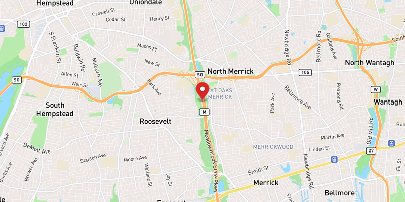
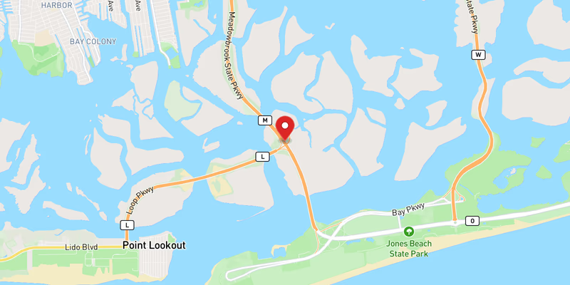
The Meadowbrook begins at its northern terminus, Exit 31A of the Northern State Parkway — the semi-directional “Westbury Interchange” near Carle Place. Heading south, it reaches Exit M1 (Old Country Road, on the Mineola–Westbury border), then Exit M2 (Zeckendorf Boulevard and Roosevelt Field Mall), the parkway’s busiest segment. It continues to Exit M3 (Merchants Concourse / Stewart Avenue, serving Nassau Community College), then the Mitchel Field corridor at Exits M4 and M5 (NY 24 / Hempstead Turnpike, Eisenhower Park, Museum Row, and the Nassau Coliseum). The parkway then meets the Southern State Parkway at Exit M6 in North Merrick — its single most important and most congested junction. South of there it passes Exit M7 (Babylon Turnpike), Exit M8 (NY 27 / Sunrise Highway), and Exit M9 (Merrick Road) in Freeport, before crossing onto the South Oyster Bay causeway, meeting the Loop Parkway at Exit M10, and terminating at the Ocean and Bay Parkways inside Jones Beach State Park.

Jurisdiction and patrol

New York State Police Troop L holds primary jurisdiction over the Meadowbrook, consistent with its responsibility for the other Long Island state parkways. The Nassau County Police Department (NCPD) provides traffic-control assistance at major incidents but is not the primary investigative agency on the parkway itself. The roadway is maintained jointly by NYSDOT and the New York State Office of Parks, Recreation and Historic Preservation (OPRHP) — a reflection of the parkway’s dual life as both a transportation corridor and a historic, parks-system road.

Speed limits

The posted limit is 55 mph across most of the parkway. Variable message signs can display lower advisory speeds during severe beach-weekend congestion, and the narrow causeway bridges over South Oyster Bay — exposed to wind and salt spray and lacking a continuous breakdown shoulder — call for reduced speeds in poor weather regardless of the posted limit.

Truck and parkway restrictions

Like nearly all New York parkways, the Meadowbrook bans commercial vehicles, trucks, and buses north of Exit M9E (Merrick Road), with low masonry bridge underpasses physically enforcing the height restriction. The one exception is the short southern causeway segment below Merrick Road, which is open to commercial traffic serving Jones Beach — which is precisely why southbound trucks are directed to exit at M9E. Drivers of tall vehicles, RVs, and box trucks should treat the parkway north of Merrick Road as off-limits.

Recent Editorial Coverage

Recent Meadowbrook State Parkway reporting from the Long Island Traffic data desk:

For the complete Meadowbrook accident archive, see /accidents/ and filter by road.

Towns Along This Route

Frequently Asked Questions

Is there traffic on the Meadowbrook State Parkway right now?

511NY feed as of 9:07 AM, Sep 28: 0 crashes, 0 closures, 1 active work zone on the Nassau Meadowbrook State Parkway. See the live section at the top of this page for locations.

What happened on the Meadowbrook State Parkway today?

511NY has carried 2 incidents on the Nassau Meadowbrook State Parkway since midnight (0 still active at 9:07 AM). The timeline at the top of this page lists each one with the time 511 reported it.

Which Meadowbrook State Parkway exits have the most crash reports?

In 511NY records for Jun 30, 2026 – Sep 28, 2026, the Nassau exits with the most crash records were Exit M1 (Old Country Road, 8), Exit M5 (NY 24 East, 4), Exit M6W (Southern State Parkway, 3). These are 511 record counts, not verified crash totals; the method is shown in the 511 incident history section.

How long is the Meadowbrook Parkway?

The Meadowbrook State Parkway is 12.52 miles long. It runs north–south entirely within Nassau County, from its southern terminus at the Ocean and Bay Parkways in Jones Beach State Park to its northern terminus at Exit 31A of the Northern State Parkway (the Westbury Interchange) in Carle Place. The route carries ten numbered interchanges, signed M1 through M10.

Does the Meadowbrook Parkway go to Jones Beach?

Yes. The Meadowbrook State Parkway is one of the primary access roads to Jones Beach State Park, crossing South Oyster Bay on a six-lane causeway to reach the beach. On summer weekends — particularly Memorial Day through Labor Day — northbound (return) traffic on Sunday evenings can back up for miles and spill onto the Southern State Parkway.

Where does the Meadowbrook Parkway meet the Southern State Parkway?

At Exit M6 in North Merrick, a partial-cloverleaf interchange with flyover ramps. On the Southern State Parkway the same junction is signed Exit 22. This is the busiest and most crash-prone interchange on the Meadowbrook. (Note: Exit M9, further south, serves Merrick Road in Freeport — it is sometimes confused with the Southern State junction.)

Can trucks drive on the Meadowbrook Parkway?

Mostly no. Like most New York State parkways, the Meadowbrook prohibits commercial vehicles, trucks, and buses north of Exit M9E (Merrick Road), and low bridge underpasses physically enforce the height restriction. The short southern segment below Merrick Road — the causeway leading to Jones Beach — is open to commercial traffic, which is why all trucks heading south must exit at M9E.

What is the speed limit on the Meadowbrook Parkway?

The posted speed limit on the Meadowbrook State Parkway is 55 mph for most of its length. On beach weekends, variable message signs may display lower advisory speeds during heavy congestion, and the narrow South Oyster Bay causeway sections warrant extra caution in wind and rain.

Who patrols the Meadowbrook Parkway?

New York State Police Troop L has primary jurisdiction over the Meadowbrook State Parkway, as it does for the other Nassau and Suffolk state parkways. The Nassau County Police Department assists with traffic control at major incidents, and the parkway itself is maintained by NYSDOT and the New York State Office of Parks, Recreation and Historic Preservation (OPRHP).

Why is the Meadowbrook Parkway so congested in summer?

The Meadowbrook is the main mainland connector to Jones Beach State Park, one of the most-visited beaches in the United States. On peak summer weekends the return flow begins around 4:00 PM and can persist past 9:00 PM, with northbound travel times stretching to 45–60 minutes across the corridor. The backup typically forms at the Southern State Parkway interchange (Exit M6) and is visible in NYSDOT monitoring data as a distinctive weekly spike.

Why is it also called the Senator Norman J. Levy Memorial Parkway?

In August 1998 the Meadowbrook was dedicated as the Senator Norman J. Levy Memorial Parkway, honoring the Nassau County state senator who served on the Senate Transportation Committee and sponsored the first seat-belt law in the United States. Memorial signage stands at both ends of the parkway and near the Babylon Turnpike interchange.

Roads That Connect to the Meadowbrook State Parkway

The Meadowbrook State Parkway interchanges directly with these Long Island highways and parkways. Check live conditions on a connecting corridor before you reroute.

Sources