Last reviewed May 15, 2026 by Dr. Dao Yuan Han, Data Editor & Lead Analyst, Long Island Traffic. PhD Mathematics · Differential Geometry · 10,000+ NY Open Data crash records analyzed.
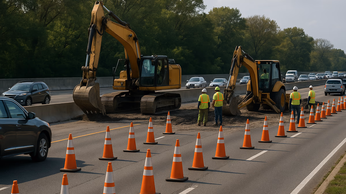
Long Island has been under construction for 40 years and shows no signs of stopping. The New York State Department of Transportation lists 90 or more active construction zones across Nassau and Suffolk on any given day. Our live construction directory tracks them in real time as they appear in the 511NY data feed. The number does not fluctuate much. It stays high.
For a Long Island commuter, that is not an occasional inconvenience. It is a permanent skill. The drivers who get through it efficiently are not the ones who avoid construction — that is impossible — but the ones who anticipate closures, know their alternates, and check the right sources at the right times.
This guide is the editorial team’s playbook.
At a Glance: The Long Island Construction Survival Kit
Highest-Impact Habits
- Check the Long Island Traffic construction directory the night before
- Cross-reference with the live traffic map the morning of
- Know your two alternates before traffic stops — see shortcuts library
- Leave 10–15 minutes earlier on weeks with significant scheduled work
- Subscribe to 511NY for verified closures
Most Useful Tools
| Source | What It Does Best |
|---|---|
| Long Island Traffic homepage | Filtered LI-only real-time view |
| Long Island Traffic Construction Directory | Active work zones by road |
| 511NY | DOT-authoritative event source |
| Google Maps / Waze | Live navigation routing |
| NYSDOT Region 10 | LI region official project page |
Why Long Island Has So Much Construction
Aging Infrastructure on a Tight Footprint
The LIE turned 50+ years old in segments dating to the 1950s and 1960s. The Southern State Parkway and Northern State Parkway date to the 1920s and 1930s. Their bridges, pavements, and drainage systems are at the end of their original design life. The reconstruction work is structural, not cosmetic.
Limited Redundancy
Long Island is a narrow landmass with water on three sides. There are very few alternate routes when one corridor closes. When a section of the LIE goes down, the Northern State and Southern State absorb the overflow — and routinely become congested themselves. We covered the structural side of this in the LIE vs. Southern State commuter risk analysis.
Major Project Cycles
Federal and state funding cycles produce multi-year waves of major work:
- The LIRR Third Track project on the Main Line
- Van Wyck capacity expansion (affecting LIE westbound flow)
- Parkway bridge reconstructions across all five major parkways
- Drainage and pavement reconstruction on aging sections
Utility Coordination
PSEG, National Grid, Suffolk County Water Authority, and local water districts run their own infrastructure projects. Utility-driven surface street closures compound the DOT work.
How Long Island Closure Sources Compare
| Tier | Source | Reliability | Best Use |
|---|---|---|---|
| 1 | 511NY direct feed | Authoritative | Verified closures |
| 2 | NYSDOT Region 10 press releases | High for scheduled work | Multi-week advance notice |
| 3 | Long Island Traffic construction directory | High (pulls Tier 1 + enrichment) | Daily planning |
| 4 | Newsday, News 12, Patch | Good context | Reporting on major events |
| 5 | Waze, Google Maps | Fast, noisy | Real-time navigation |
Tier 1: 511NY Direct Feed
511NY is the New York State DOT’s authoritative system. It pulls from DOT maintenance, state police, and contracted construction operators. When 511NY says a lane is closed, it is closed. The main weakness is the 10–30 minute lag from incident to feed update.
Tier 2: NYSDOT Press Releases
For scheduled long-duration closures (weekend ramp closures, multi-week bridge deck replacements), the NYSDOT Region 10 office issues press releases days or weeks ahead. These are the most reliable source for anticipating closures that have not yet happened.
Tier 3: Long Island Traffic Construction Directory
Our construction directory and homepage map draw from the 511NY feed plus our own enrichment layer. We filter, geocode, and present the data in a way that matches Long Island commuting needs.
Tier 4: Local News
Newsday, News 12 Long Island, Patch, and ABC7 New York cover major construction projects with context. Less useful for granular weekend ramp work, which local newsrooms underreport.
Tier 5: Crowdsourced Apps
Waze and Google Maps incorporate user reports — fast but noisy. A user report of “construction” may be active construction, a single utility truck, a road race, or a misread of road geometry. Use crowd reports as early-warning, not as confirmation.
What Closes, When, and Why
Scheduled vs. Unscheduled
Scheduled closures cluster:
- Weekends, especially overnight Friday into Saturday and Saturday into Sunday
- Off-peak weekday hours (10 AM – 3 PM, 8 PM – 5 AM)
- Spring and fall, when temperatures support asphalt and concrete work
Unscheduled closures cluster:
- Rush hour, when crash density peaks
- Winter storms
- Holidays with high impaired-driving rates — see our DWI crash data analysis
Weekend Patterns
A typical Long Island weekend has:
- 2–4 LIE ramp closures, usually in Suffolk County
- 1–3 Southern State or Northern State ramp or shoulder closures
- 2–6 surface street closures for water main work, utility trenches, paving
- Occasional full closures of Wantagh Parkway sections for bridge work
Our construction directory lists active closures by road with start and end dates where available.
Seasonal Patterns
| Season | What Drives It |
|---|---|
| Spring (Mar–May) | Pothole patching peaks. Bridge work resumes. Pavement marking renewal. |
| Summer (Jun–Aug) | Major project work. Beach + Hamptons traffic compounds. |
| Fall (Sep–Nov) | Final paving and striping before freeze. Bridge work pushes to completion. |
| Winter (Dec–Feb) | Most road work stops. Emergency repairs only. |
How to Plan a Long Island Commute Around Construction
Daily Commuters
If you drive the LIE every day, the highest-return habit is checking the construction directory on Sunday evening.
- Check the directory for your road and time of travel
- Cross-reference with our live traffic map for active incidents
- Identify one alternate route in advance — do not improvise mid-commute
- Leave 5–15 minutes earlier on days with significant overlap
The single largest commuter time-saving trick on Long Island is being the driver who already knows the alternate before traffic stops. Our shortcuts library maps the most useful ones:
- LIE Exit 49 bypass
- LIE service road trick
- Sagtikos to Southern State
- Northern Boulevard Queens bypass
- Sunrise Highway vs. LIE
Weekend Travelers
Heading to Jones Beach Saturday morning? Hamptons Friday afternoon? JFK Sunday evening?
- Check the construction directory for the corridor
- Plan to leave outside the obvious peak — 7 AM beach trips beat 10 AM, 10 AM Hamptons departures beat 3 PM
- Read the relevant shortcut guide:
- Keep an alternate fueling plan if a planned gas stop is on the affected route
Same-Day Reroutes
When you discover a closure on the day of travel — parkway shut, LIE at a crawl — the playbook depends on where you are:
| If you are on… | Use as alternate |
|---|---|
| LIE between Exit 30 and Exit 50 | LIE service road trick or Northern State |
| Southern State Parkway | Sunrise Highway parallel |
| LIE in eastern Suffolk | Route 25 or Route 25A |
| Wantagh or Meadowbrook | Seaford-Oyster Bay Expressway |
| Sunrise Highway east end | Montauk Highway (slow but reliable) |
Special Closure Categories
Bridge Closures
Bridge closures get the most attention because they affect long stretches at once. The Cross Bay Bridge, Robert Moses Causeway, and major LIE overpasses (Wantagh Avenue, Route 110) all have multi-year reconstruction projects on the horizon. Watch the construction directory and our accident analysis hub for ongoing coverage.
Ramp Closures
The most common category. A single ramp closure can add 10–20 minutes if your alternate is significantly longer. The LIE Exit 49 bypass and LIE Exit 49 service road examples cover the most common scenarios.
Full Roadway Closures
Rare but disruptive. A full closure of the Southern State Parkway for a fatal-crash reconstruction can last 4–8 hours. Full closures for LIRR Third Track construction are typically overnight and overnight only.
Weather-Driven Closures
Snow on the Wantagh and Northern State can result in temporary commercial vehicle bans and partial lane closures. Hurricanes have produced full coastal closures along Montauk Highway and Ocean Parkway.
Major Long Island Projects to Watch in 2026
Specific projects that affect routing decisions across Nassau and Suffolk:
LIRR Main Line Third Track (Ongoing)
The third track project is in its final phases, with grade crossings being eliminated and stations rebuilt. The LIRR Main Line communities (Mineola, Westbury, Hicksville, Carle Place) see periodic surface-street closures and overhead-bridge work. The MTA LIRR project page has scheduled updates.
LIE Bridge Replacements
Multiple LIE overpasses are being rebuilt on a rolling schedule. Each replacement produces weeks of ramp closures on adjacent exits. Check the construction directory before committing to a particular LIE route.
Southern State Parkway Wantagh-to-Bethpage Reconstruction
Pavement and shoulder work on this section produces persistent lane reductions during work hours. Our Southern State Parkway problem report covers the structural context.
Nassau County Road Resurfacing Program
Nassau County’s DPW runs an annual resurfacing program affecting county-maintained roads. Notice typically comes 24–72 hours in advance. Surface street disruption is shorter-duration than highway work but harder to anticipate.
When a Closure Becomes a Crash
Sometimes the closure you are sitting in is a crash investigation. If you witness an accident on Long Island:
- Pull over safely if you are an actual witness
- Provide your contact information to the responding officer
- Do not exit your vehicle on a parkway if it is not safe
If you are involved in the crash, see our How to Handle a Car Accident on Long Island guide. The Know Your Rights library covers the legal side, including insurance claims and hit-and-run scenarios.
Construction-zone crashes have specific liability considerations. Contractor negligence is a recognized claim category in NY — see our Know Your Rights: Car Accidents guide for the framework. Recovery for construction zone accident injuries on the LIE, Southern State, or any Long Island work zone often turns on whether the contractor complied with the Manual on Uniform Traffic Control Devices (MUTCD Part 6) — proper taper lengths, advance warning distance, channelization, and reflective barriers. When those are missing, liability shifts from the driver to the contractor and the responsible agency.
Tools That Actually Work
For Long Island commuters specifically:
-
Long Island Traffic — homepage map, accident reports, construction directory, road profiles covering Nassau and Suffolk. We filter and present in a way that matches how Long Islanders drive.
-
511NY — authoritative source, raw and unfiltered. Use as backup.
-
Google Maps — best for navigation once you have decided on a route. Less useful for advance planning because it does not surface scheduled future closures.
-
Waze — best for active routing around real-time incidents. Crowd reports are fast but noisy.
-
MTA / LIRR alerts — if you are considering transit alternatives, the LIRR live status by branch is the right starting point. See our LIRR vs. driving safety tradeoff analysis for the structural decision.
FAQ: Long Island Construction and Closures
How do I find out about LIE construction tonight? Check the Long Island Traffic construction directory or the 511NY feed directly. Most scheduled overnight work is posted 24–72 hours in advance.
Does Long Island ever have road work that closes the whole highway? Rarely, but yes. Full closures of the LIE are typically overnight (10 PM – 5 AM) for major work. Full Southern State closures happen during fatal-crash reconstructions. Cross Bay and other bridge replacements have occasional full closures.
How can I avoid construction on my daily commute? Two habits: check the directory the night before, and keep an alternate route in mind. Our shortcuts library maps the routes experienced commuters use for specific bottleneck patterns.
Are construction zones more dangerous than regular roads? Yes. NHTSA data shows work-zone crashes have higher injury severity per crash than non-work-zone crashes. Reduced lane width, lane shifts, and stopped traffic ahead of the zone all contribute. Slow down, increase following distance, expect slowdowns.
Can I get a refund or compensation if construction makes me late? Generally no, unless you have a specific service contract that depends on transit time. Construction-related delays are not actionable against the state in most circumstances.
What if construction damaged my vehicle (debris, exposed rebar, etc.)? File a claim with the responsible party — NY State DOT for state-maintained roads, Nassau or Suffolk County DPW for county roads, the contractor for active work zones if their negligence caused the damage. Notice of claim is required within 90 days under GML §50-e. Document the damage with photographs and keep all repair receipts.
Which Long Island road has the most construction right now? Varies week to week. As a generalization, the LIE in Suffolk County has the most consistent ongoing work, followed by the Southern State bridge program.
Does construction affect my insurance claim if I crash in a work zone? Possibly. Contractor negligence is a recognized claim category in NY. If you crash in a work zone due to inadequate signage, missing lane markings, or hazardous debris, the contractor may share liability with the responsible state or county agency. Document the conditions and consult a NY personal injury attorney — see our Know Your Rights: Car Accidents guide.
Are there always alternates available on Long Island? Almost always, but they vary in quality. In eastern Suffolk where road density is lower, an LIE closure between Riverhead and Manorville has only Route 25 and Sound Avenue as alternates — both slower. In Nassau, redundancy is much better; nearly every LIE segment has a parkway alternate within 2–3 miles.
How long are typical Long Island construction projects? Highly variable. Surface paving: 1–3 weeks per segment. Ramp replacement: 4–12 weeks. Bridge deck replacement: 8–20 weeks. Bridge full reconstruction: 18 months to 4 years. LIRR Main Line third-track grade crossings: typically 18–24 months per location.
Can I report a damaged or dangerous road to the DOT? Yes. The NY DOT report-a-problem page accepts pothole and road condition reports. Nassau County and Suffolk County also have their own DPW reporting systems for county-maintained roads.
Authority and Sources
- 511NY (NY State DOT) — authoritative real-time travel feed
- NYSDOT Region 10 — Long Island regional DOT office
- MTA LIRR Expansion Project — Main Line third-track schedule
- Nassau County DPW — county road work
- Suffolk County DPW — county road work
- Long Island Traffic Construction Directory — active work zones
Related Long Island Traffic Coverage
- Long Island Traffic Construction Directory — live active work zones
- Long Island Shortcuts Library — alternate routes
- Long Island Road Profiles — geometry and traffic patterns
- Top 10 Traffic Safety Tips for Long Island Drivers
- Best Apps for Real-Time Traffic Updates
- Top Traffic Management Solutions for Long Island Businesses
- Long Island’s Most Dangerous Roads
- The Southern State Parkway Problem
Dr. Dao Yuan Han is the Data Editor & Lead Analyst at Long Island Traffic. Our construction directory updates regularly from 511NY data. For the structural analysis behind Long Island’s most affected corridors, see his data-driven analysis of dangerous roads and Southern State Parkway problem report.