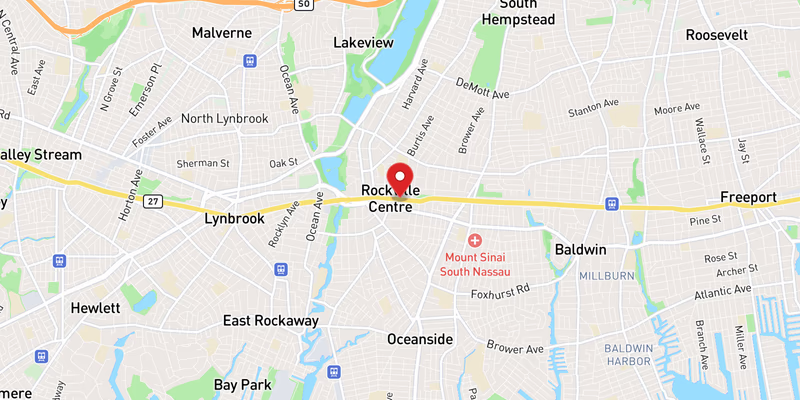
Flooding Closes Left Lane on Eastbound NY 27 in Nassau County

Flooding Closes Left Lane on Eastbound NY 27 in Nassau County. in rockville centre. August 3, 2026.

Updated Aug 3, 2026
MODERATE INCIDENT
1 Left lane closed lanes affected
eastbound · Rockville Centre NY 27
Road
NY 27
Direction
eastbound
Town
Rockville Centre
County
nassau County
Reported
Updated
Source
511NY
Flooding Closes Left Lane on Eastbound NY 27 in Nassau County
📍Reported incident location Open in Google Maps →

What Happened

Flooding on eastbound NY 27 in Nassau County prompted the closure of the left lane on Monday, August 3, 2026. The incident was classified as moderate severity, with one lane — the leftmost — blocked for eastbound travelers along the corridor. No injuries, vehicle collisions, or stranded motorists were reported in connection with this specific flooding event.

The flooding was one of multiple water-related disruptions recorded on NY 27 that day. At least two separate flooding incidents on the same road were logged on August 3, alongside a crash on NY 27, suggesting that broader weather conditions were affecting the route throughout the day. Roadwork was also active on both NY 27 and the parallel NY 27A on the same date, compounding the congestion picture for Nassau County drivers.

No specific cross-street, exit number, or town within Nassau County was identified in the initial report. Police have not yet confirmed the precise trigger point of the flooding or any drainage infrastructure involvement.

Location & Road Context

NY 27 — commonly known as Sunrise Highway through much of its length — is one of Long Island’s primary east-west arterials, running from Queens through Nassau and into Suffolk County. It serves as a critical commuter and commercial route, particularly for communities in southern Nassau. Our NY 27 incident database shows 1,247 recorded incidents on this road, underscoring how frequently disruptions occur along the corridor. Nassau County as a whole accounts for 982 recorded accidents in our local database.

August flooding events are not unusual on low-lying stretches of NY 27, where storm drainage can be overwhelmed during heavy rain. On the same day, a separate crash on NY 27 was also recorded as a moderate-severity event, and drivers on nearby I-495 and the Northern State Parkway also faced incidents, indicating a regionally challenging day on Nassau roads.

Broader Impact

Localized lane flooding on a high-volume arterial like NY 27 can compress two lanes of eastbound traffic into one, creating rear-end collision risk — particularly in reduced-visibility conditions. Drivers approaching flooded lanes are reminded that Nassau County roadways in low-lying areas are especially susceptible to standing water during summer storm events, and that even shallow water can cause hydroplaning at highway speeds. Motorists should check 511NY for real-time lane status before traveling the corridor.

Topics

NY 27Rockville CentreNassau CountyNassau County accidentNY 27 trafficNY 27 accident todayRockville Centre trafficRockville Centre accidentLong Island accident todayLong Island traffic todayLong IslandNY

Frequently Asked Questions

Where did this happen?

The flooding occurred on NY 27 eastbound in Nassau County, Long Island. The left lane was closed due to the flood conditions. An exact cross-street or milepost was not specified in the initial report.

What lanes were affected by the flooding on NY 27?

The left lane of eastbound NY 27 was closed as a result of the flooding. The right lane remained open, allowing traffic to pass through the affected area, though delays were likely.

Were there other incidents on NY 27 the same day?

Yes. On the same day, August 3, 2026, at least two additional flooding incidents and one crash were recorded on NY 27, along with roadwork on both NY 27 and NY 27A, making it a particularly disrupted day on the corridor.

How severe was the flooding incident on NY 27?

The incident was classified as moderate severity. One lane was impacted — the left lane eastbound — suggesting localized flooding rather than a full road closure.

Disclaimer: Incident information on this page is compiled from public sources including police reports, traffic agencies, and news outlets. It is provided for informational purposes only and may not reflect the most current status of this incident. Do not rely on this information for legal, insurance, or emergency decisions. For emergencies, call 911.